Satellite Dataset
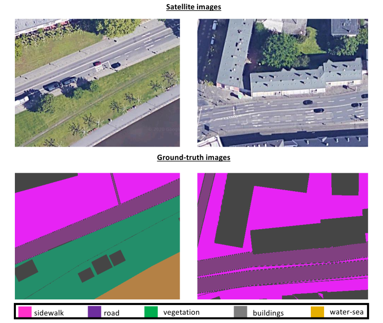
This satellite dataset consists of overhead imagery from Google Maps (using the Google Maps Downloader - http://allmapsoft.com/gmd/), which are sufficiently orthorectified and georeferenced for the purposes of our application. Note that, the highest GSD resolution allowed from the service along the x and y axes was computed at Sx = 8cm/pixel and Sy = 7cm/pixel, respectively. Specifically, a set of 360 × 480 × 3 images is created, in order to feed a neural network (such as SegNet).
We propose the division of the available data into three subsets for training, validation and testing, containing 60-20-20 percent of the available samples, respectively.
Finally, we manually annotated all samples with respect to six semantic labels, namely, buildings, sidewalks, roads, water, vegetation and terrain, creating the required ground-truth for each frame.