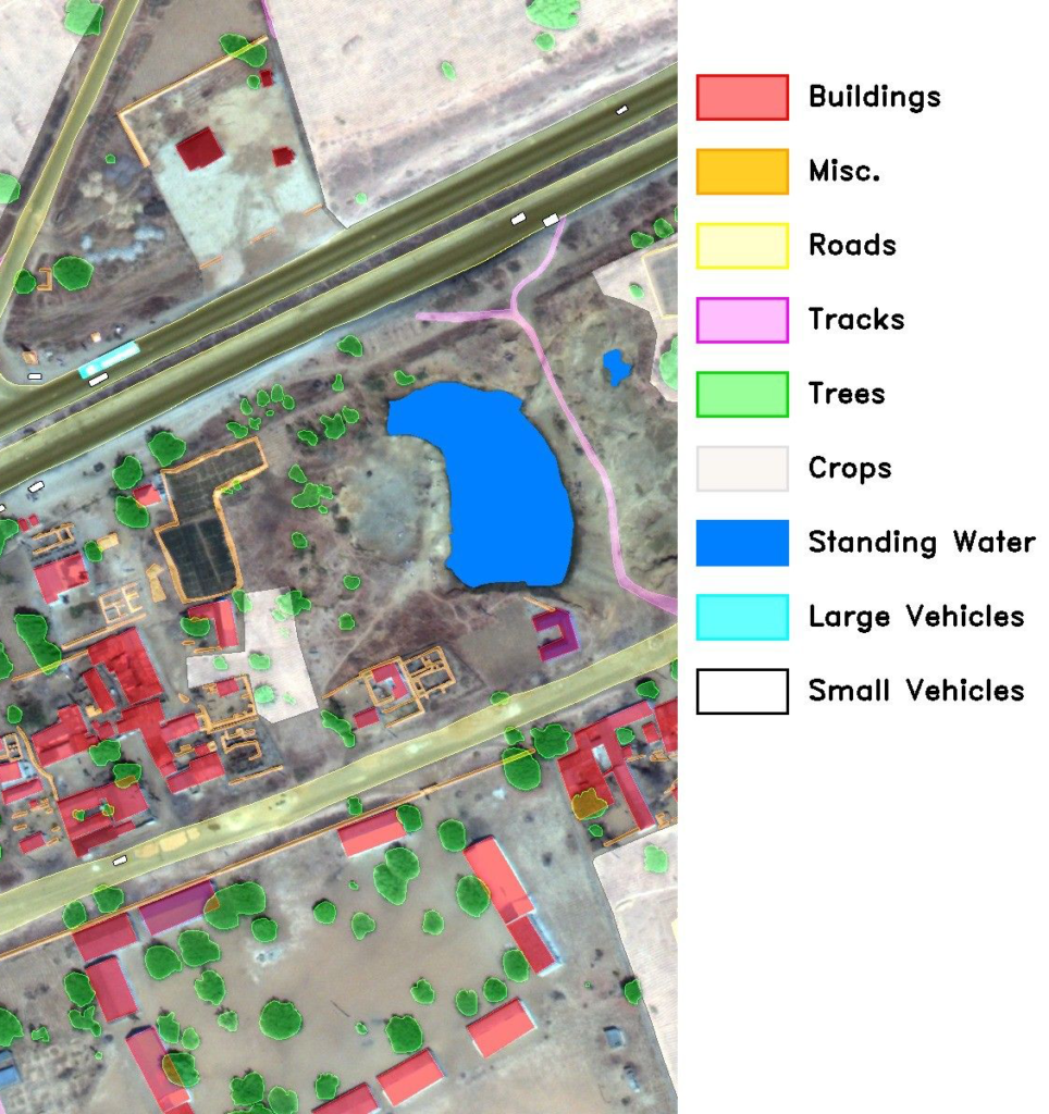
The main purpose is the creation of an integrated system where it will create integrated semantic maps that will be obtained by combined processing of satellite data and images taken in real-time when the robot is moving. The proposed integrated semantic map aims to fully identify the position of the vehicle/robot in the real-world space with or without the use of the Global Positioning System (GPS), while at the same time being familiar with the interpretation of the surrounding space. Most importantly, knowing the semantic map, any vehicle/robot movement will enhance semantic information/entities on the map. In addition, localization of the robot’s position and orientation on the map by satellite images, knowing the semantic area or entity in which the robot is located, enables it to predict the next semantic region/entity that is recorded on the semantic map from satellite images. In the case that entities are not located in the primary semantic map, the robot will update it, when appearing new semantic entities. In conclusion, a new robot (autonomous vehicle) that follows the same traversed route as the original, will know a semantic enhanced map of the area, and through cloud services, it will be able to contribute itself to updating the map.